“知行合一”,“敬天爱人”, 秉承经典传统人文理论,鉴古铸今,重视长久均衡发展,承认每个具有创造力的聪明才智是团队前行的重要推动力,鼓励创新,为社会创造价值, 保持企业活力基业长青。
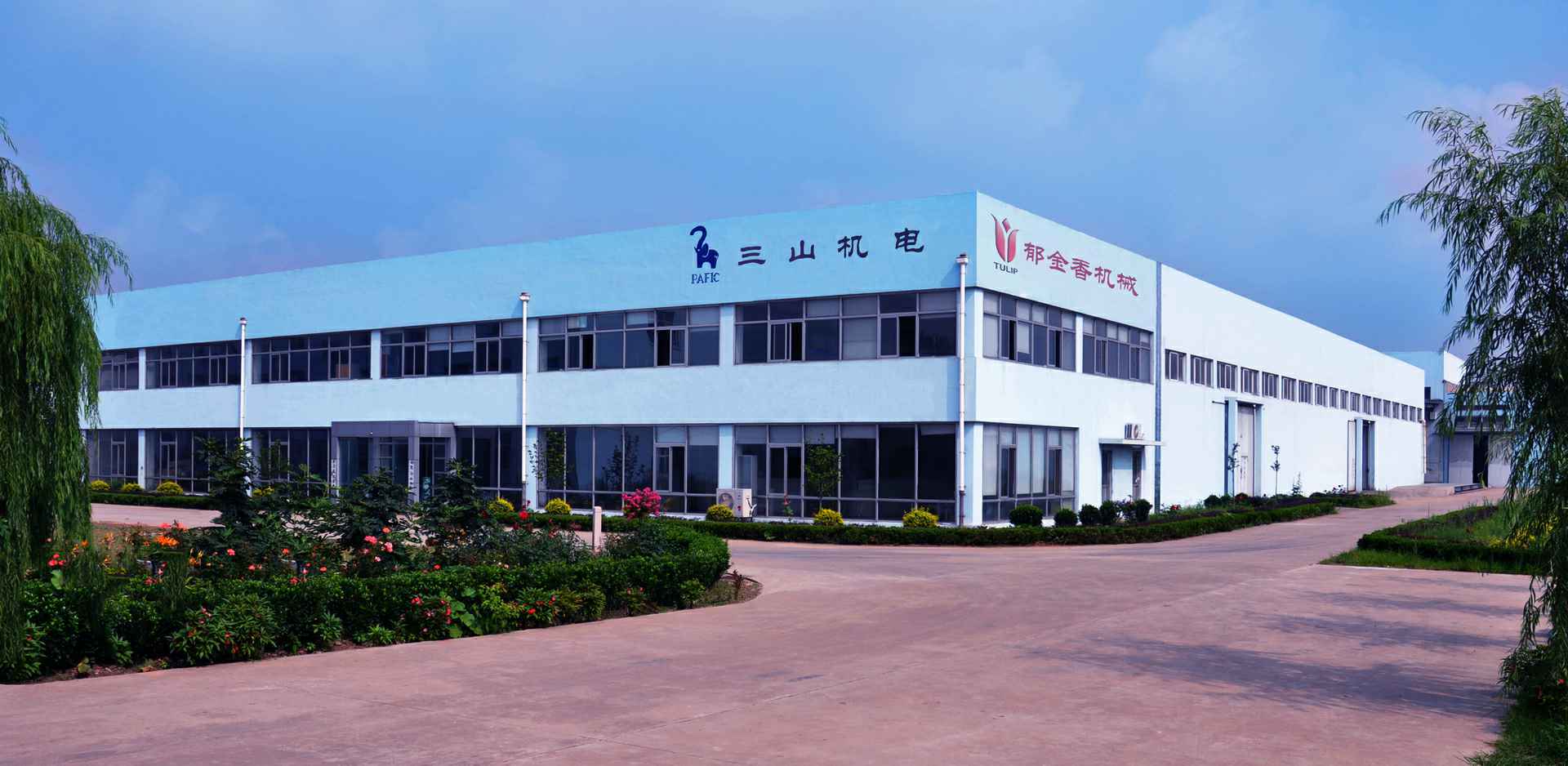
全球布局
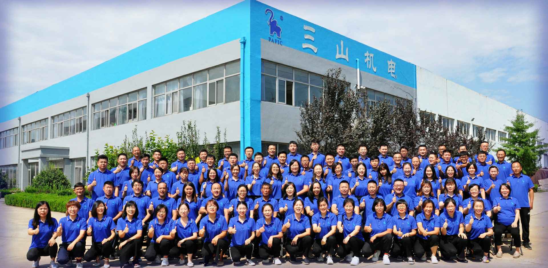
创新体系
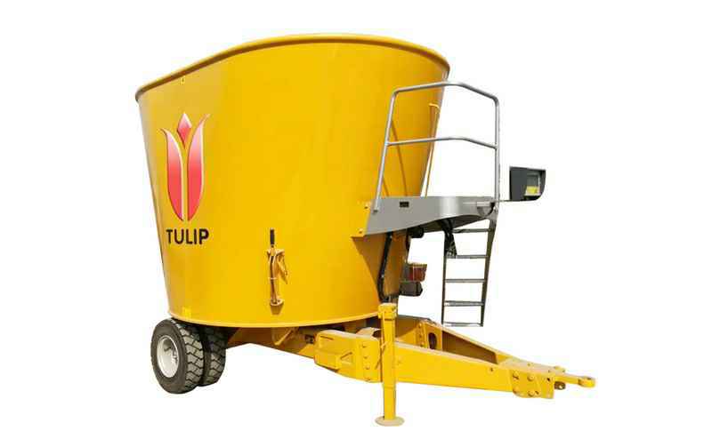
TULIP牌进口全混日粮饲料搅拌机(固定式)
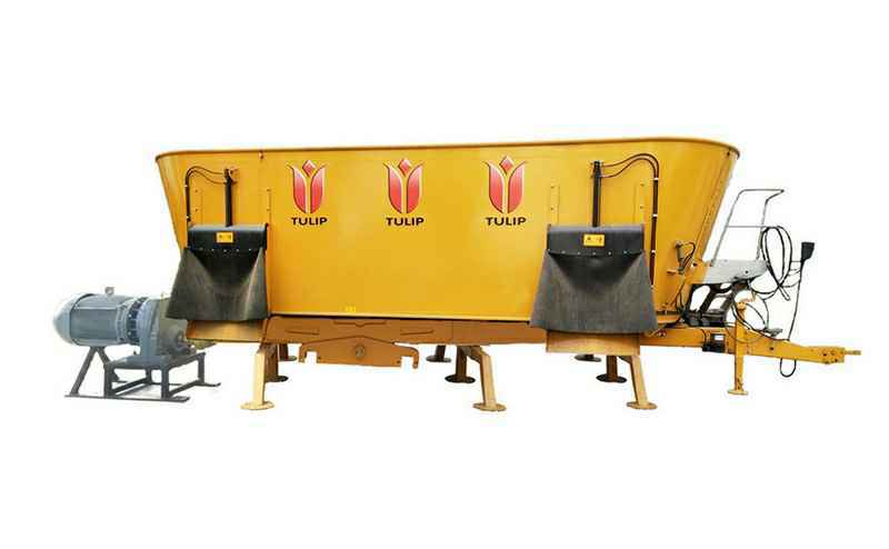
TULIP牌进口全混日粮饲料搅拌机(牵引式)
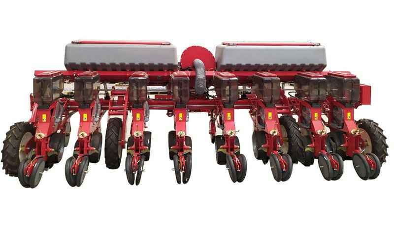
辈康气吸式精量播种机
PEECON牌进口动力耙
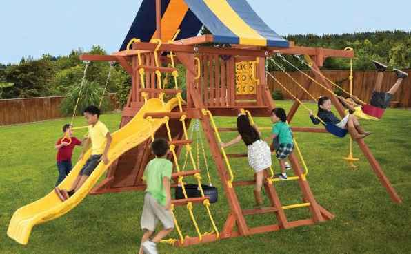
木制组合滑梯一
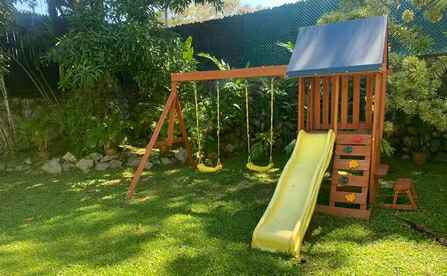
木制组合滑梯二
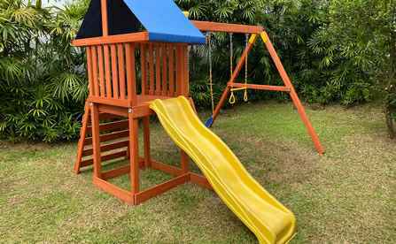
木制组合滑梯三
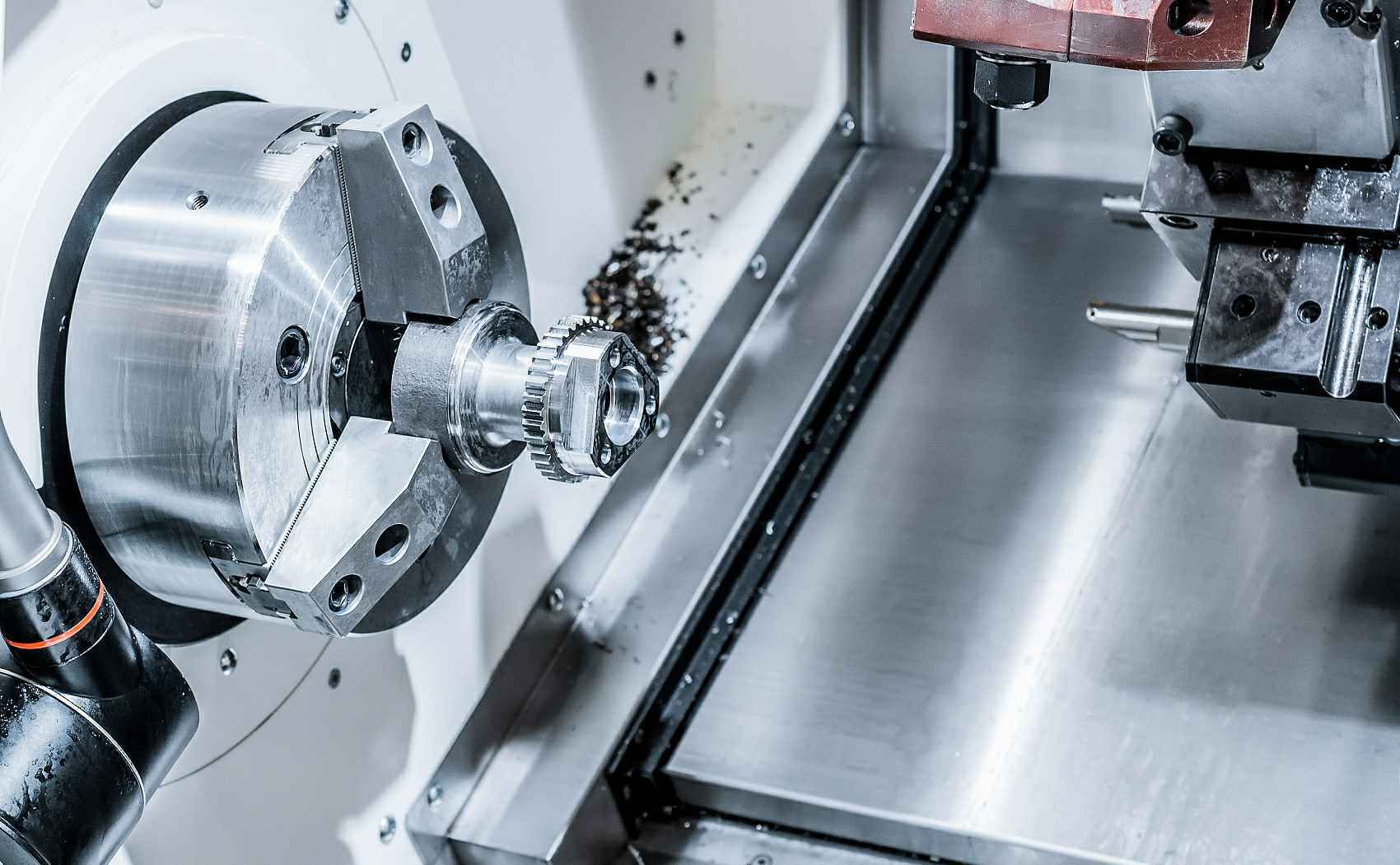
机加工产品
激光切割产品
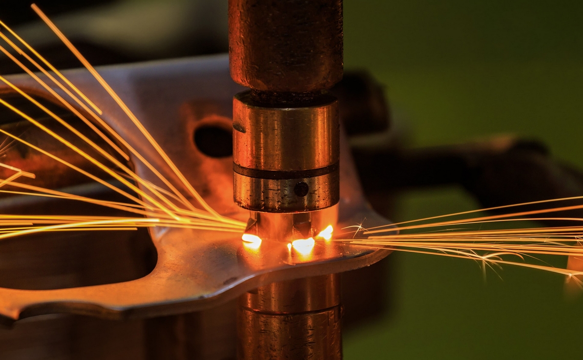
高频点焊产品
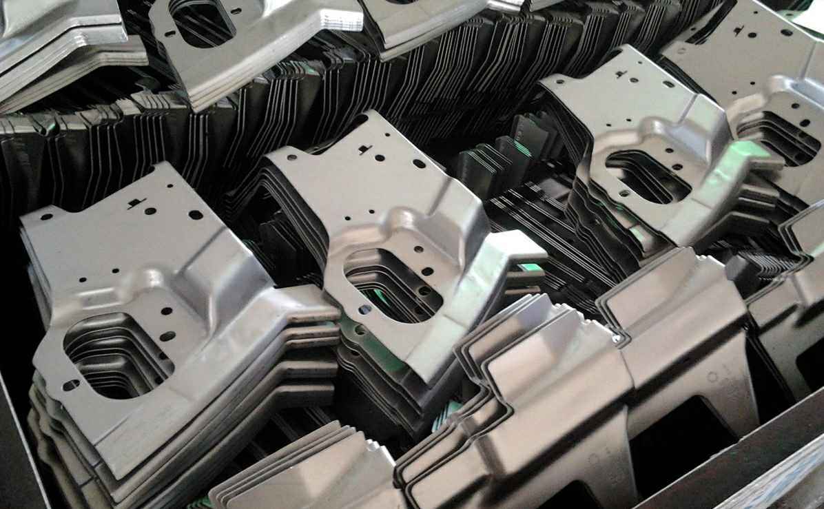
冲压产品
公司集团销售铁军训战营顺利结营
疫情防控,我们在行动。
恭喜我司在2022年1月19日荣获胶州首批“经核准出口商”
大连雄杰可持续发展战略有限公司为全面展示在新发展格局下取得的突出成果,助力乡村振兴和智慧农业发展,携气吸式精量播种机、驱动耙两大类产品、全明星阵容亮相展会,全方位展示中国智能农机装备的创新能力和领先科技,吸引了众多与会者的目光。
7月17—19日,由中国奶业协会主办的以“展成果 谋方略 绘蓝图 点亮两个百年交汇点”为主题的第十二届中国奶业大会暨2021中国奶业展览会在安徽省合肥市召开。大会全面总结了“十三五”奶业发展成就,系统谋划了“十四五”奶业战略发展,为奶业振兴和现代化建设贡献智慧和力量。大会参展企业555家,展位面积约8万平方米,同时举行了16场专题论坛,为行业提供交流、合作的平台。
金秋丰盈,硕果飘香。10月11—13日,“科学饮奶 品质消费 全面小康 践行健康中国战略”第十一届中国奶业大会暨2020中国奶业展览会在河北省石家庄市隆重召开。